
The best things to do in Zion National Park are the Riverside Walk, the Narrows, the Emerald Pools and Watchman trails, a ranger program and a night of stargazing. Angels Landing also belongs on the list, but its chained ridge needs a permit won through a lottery on Recreation.gov. Many of the shorter trails take one to two hours.
Best Things to Do in Zion National Park at a Glance
Zion's paved walks along the Virgin River are easy, while the Narrows and the permit-only climb to Angels Landing are strenuous. Several start from shuttle stops: the Riverside Walk at the Temple of Sinawava (stop #9) and the Angels Landing route at the Grotto (stop #6).
| Activity | Time | What to expect |
|---|---|---|
| Riverside Walk | 1 to 2 hours | Paved, mostly flat river walk to the start of the Narrows |
| Pa'rus Trail | 30 to 120 minutes | Paved path with views of the Watchman; open to bikes, wheelchairs and leashed pets |
| Weeping Rock | 15 to 45 minutes | Short, steep, paved climb to an alcove with dripping springs |
| Lower, Middle or Upper Emerald Pools | 1 to 2 hours each | Rough pavement, sandstone ledges and stone steps to pools and ephemeral waterfalls |
| Watchman Trail | 1 to 2 hours | Unpaved climb to a viewpoint over lower Zion Canyon and Springdale |
| Kayenta Trail | 2 to 3 hours | 2.0 mi river trail that climbs to the Emerald Pools, with long drop-offs |
| Canyon Overlook | 1 to 2 hours | Rocky trail east of the tunnel to a view of Pine Creek Canyon |
| The Narrows | 1 to 8 hours | Wading up the Virgin River through a slot canyon |
| West Rim to Scout Lookout | 3 to 4 hours | Steep switchbacks climbing about 1,000 ft |
| Angels Landing (from Scout Lookout) | 1 to 2 hours | Chained ridge; permit required |
| Ranger-led activity | 20 to 120 minutes | Talks on geology, wildlife, art and human history |
| Stargazing | After dark | International Dark Sky Park |
For an easy first day, pair the Riverside Walk with Weeping Rock and finish on the Pa'rus Trail. If you want more climbing, the Emerald Pools trails and the Watchman Trail each deliver it. Give the Narrows or Angels Landing a separate day, since both are strenuous.
Things to Do in Zion National Park Without a Long Hike
Paved paths along the Virgin River put Zion's sandstone walls right beside you without a long climb.
The Riverside Walk starts at the Temple of Sinawava, past the shuttle stop and restrooms, and follows the river as the canyon walls narrow in. It is mostly flat for the first half-mile, with exhibits on canyon carving and erosion along the way. Turn around where the pavement ends if you want to stay dry, and look at Riverside Walk conditions in winter, when icy sections can close.
The Pa'rus Trail takes its name from the Paiute word for "bubbling water" and links the Zion Canyon Visitor Center with Canyon Junction. It is paved, open to wheelchairs, bicycles and leashed pets, and has some of the best views of the Watchman. Bikes can also ride Zion Canyon Scenic Drive, which everyone else reaches by free shuttle for most of the year.
- Weeping Rock is short but steep: a paved path from the parking area crosses a bridge and ends at steps up to a rock alcove with dripping springs.
- Grotto Trail connects Zion Lodge to the Grotto, runs near the road most of the way, and is a great place to view wildlife.
- Canyon Overlook, just east of the tunnel, follows a rocky trail with mostly fenced drop-offs to a view of Pine Creek Canyon and lower Zion Canyon. You must turn right to enter or leave its small lot, so be ready to circle back several times for a space.
Parking in Zion Canyon fills quickly, even though the Zion Canyon Visitor Center lot holds more than 350 spaces. When it is full, park in Springdale for a fee and ride the shuttle in, or use the other lots listed on the directions and parking page. Every visitor pays the park entrance fee or shows a valid pass, and the America the Beautiful pass guide covers the pass option.
Moderate Zion Hikes to Emerald Pools, Watchman and Kayenta
The Emerald Pools trails, the Kayenta Trail and the Watchman Trail climb to wide canyon views.
Three connected trails lead to the Emerald Pools. The Lower Emerald Pool Trail is rough pavement through pinyon-juniper woodland to the lower pool and its ephemeral waterfalls. Stay out of the water: the pools are fragile and serve as a water source for wildlife.
The Middle Emerald Pools Trail runs along an unpaved sandstone ledge above the lower trail, with a steep start that opens onto views of main Zion Canyon. Farther on, the trail tucks into the red sandstone and finds shade. The Upper Emerald Pools Trail climbs stone steps to a sandy path that ends at the base of towering canyon walls, and you can reach it from the Kayenta, Lower or Middle trails.
The Kayenta Trail runs 2.0 miles along the Virgin River before climbing to the Lower and Upper Emerald Pool trails, with panoramic views of Zion Canyon. Long drop-offs line parts of the route. Walk back the same way, or make a loop by coming down one of the Emerald Pools trails.
The Watchman Trail is an out-and-back that starts flat by the river and climbs to a viewpoint over the Watchman, the Temples and Towers, lower Zion Canyon and Springdale. The ground is sandy, rocky and uneven, so wear shoes with grip.
For a hike with a geology story, try the Sand Bench Trail. It climbs a landslide that dammed the Virgin River 8,000 years ago and backed up a lake reaching as far as Angels Landing. For part of the year it also serves as a commercial horse trail.
Planning for the Narrows and Angels Landing
The Narrows and Angels Landing are both strenuous hikes, and each one needs a plan before you reach the trailhead.
The Narrows
The Narrows follows the Virgin River through a slot canyon, and after the first mile on the paved Riverside Walk, the river is the trail. You wade, walk and sometimes swim over slippery, uneven rocks in water anywhere from ankle to chest deep. Most of the route stays in shade all day, even in summer, and flash floods and hypothermia are constant dangers.
The Narrows may close when the river flows above 140 cubic feet per second, which often happens in late-summer monsoon season and during spring runoff. A day hike needs no permit as far as Big Spring, but going beyond Big Spring or up Orderville Canyon requires a Wilderness permit. There is no set end point, so turn around before you feel tired and read current Narrows conditions the morning you go.
Angels Landing
Since April 1, 2022, the National Park Service (NPS) has required a permit for every hiker who continues from Scout Lookout onto Angels Landing. Permits come through a lottery on Recreation.gov, which charges $6 to enter and $3 per person if you win a permit. The Angels Landing trail page lists the lottery details and trail rules.
The route starts at the Grotto: cross the road and bridge to the sandy West Rim Trail. From there you climb about 1,000 feet of switchbacks to Scout Lookout, with a break from the heat in Refrigerator Canyon. The short Angels Landing Trail then follows a ridge often less than 3 feet wide, with chains as handrails, two-way traffic and sheer drop-offs of up to 1,000 feet on each side.
Restrooms sit at Scout Lookout and the Grotto, and water is at the Grotto. If narrow ledges over long drops make you uneasy, or the lottery does not go your way, hike to Scout Lookout and turn back there. You still get the switchbacks and the views from high above the canyon floor, with no Angels Landing permit needed.
Ranger Programs, Climbing and Stargazing
Ranger programs, big-wall climbing and a dark night sky fill the hours around Zion's hikes.
Rangers lead a variety of activities throughout the year on topics from geology and wildlife to art and human history, and the schedule sits on the park's Events Calendar, linked from the ranger-led activities page. Zion's 2,000-foot sandstone cliffs are known worldwide for big-wall climbs. Most routes are not recommended for inexperienced climbers because of their difficulty and the soft rock, and every overnight climbing trip needs a permit.
Stargazing
Zion is an International Dark Sky Park, so the park gets very dark after sunset. The darkest skies are on the east side and along Kolob Terrace Road, and Checkerboard Mesa pullout, Lava Point Overlook and Timber Creek parking lot all offer flat ground and a wide view for a telescope. In Zion Canyon, the Pa'rus Trail and the Zion Human History Museum patio are recommended spots, and the patio is accessible with seating.
Spots on Zion Canyon Scenic Drive are reached only by shuttle for most of the year. The east side, Kolob Terrace Road and Kolob Canyons locations stay open to drivers year-round, and all have restrooms except Checkerboard Mesa pullout. Prepare with these steps from the park's stargazing page:
- Stargaze before moonrise or after moonset; the darkest nights fall in the week before a New Moon.
- Use only red light, because white light from phones, headlamps or car headlights costs you 20 to 30 minutes of night vision.
- Bring jackets, blankets, food and water, since the desert turns chilly after dark and no food is available in the park at night.
- Download a star app or pack a planisphere before you arrive, because you should not count on cell service in the park.
- Know where you will sleep: camping is allowed only at designated sites or with some Wilderness permits.
To line up more dark nights on the same trip, browse the list of Dark Sky Parks in the US.
Kolob Canyons and Kolob Terrace Road
Kolob Canyons, in Zion's northwest corner just south of Cedar City, offers canyon views and wilderness trails apart from Zion Canyon. The Kolob Canyons Visitor Center and scenic drive sit off Interstate 15, 40 miles from Zion Canyon and 17 miles south of Cedar City, and you drive there in your own vehicle.
| Kolob trail | Time | Highlights |
|---|---|---|
| Timber Creek Overlook | 30 to 60 minutes | Ridge walk to views of Timber Creek, Kolob Terrace and the Pine Valley Mountains |
| Taylor Creek Trail | 3 to 4 hours | Middle Fork of Taylor Creek past two homestead cabins to Double Arch Alcove |
| La Verkin Creek Trail to Kolob Arch | 7 to 9 hours | Starts at Lee Pass and descends toward La Verkin Creek through primitive Zion Wilderness |
Groups on Wilderness trails such as Taylor Creek are capped at 12 people. Kolob Terrace Road is a separate drive that begins in the town of Virgin, 13.5 miles west of the Zion Canyon Visitor Center, and leads to Lava Point Overlook and the Wildcat Canyon and Left Fork trailheads. Its trailhead lots are mostly dirt or gravel with limited space, so arrive early and have a backup plan.
Days to Plan for Zion National Park
Two days covers Zion's paved walks plus one strenuous hike, and a third day adds Kolob Canyons or a late night of stargazing. Adding the trail ranges together gives a rough length for each day before drive time and stops.
| Day plan | Stops | Trail time |
|---|---|---|
| Easy canyon day | Riverside Walk (1 to 2 h) + Weeping Rock (15 to 45 min) + Pa'rus Trail (30 to 120 min) | 1 h 45 min to 4 h 45 min |
| Pools and viewpoint day | Kayenta Trail loop (2 to 3 h) + Watchman Trail (1 to 2 h) | 3 to 5 hours |
| Angels Landing day | West Rim to Scout Lookout (3 to 4 h) + Angels Landing (1 to 2 h) | 4 to 6 hours |
| Narrows day | The Narrows (1 to 8 h) | Set by your turnaround point |
| Kolob day | Timber Creek Overlook (30 to 60 min) + Taylor Creek Trail (3 to 4 h) | 3.5 to 5 hours |
With one day, pick the easy canyon day or the pools day and leave the Narrows and Angels Landing for another trip. With two days, add one of those strenuous hikes. With three, add Kolob Canyons, which is a separate drive from Zion Canyon.
Two things would change that plan. If the Virgin River runs above 140 cubic feet per second and the Narrows closes, swap in the Kayenta loop or Canyon Overlook. If you win an Angels Landing permit, build the rest of the trip around that day.
If exposed drop-offs or cold, deep river water rule you out, skip both strenuous hikes. Spend the extra day on the paved trails, a ranger program and an evening on the Pa'rus Trail instead.
Zion and Bryce Canyon in One Trip
Zion and Bryce Canyon fit into one road trip, linked by the Zion-Mt. Carmel Highway out of Zion's East Entrance. Vehicles too large for the stretch between Canyon Junction and the East Entrance must reroute through Springdale. The detour via Highway 20, north of Cedar City, runs roughly 150 miles and takes about 2.5 hours.
That route is 63 miles longer than the Zion-Mt. Carmel Highway, yet it adds only about 42 minutes, because the highway through the park usually moves at under 30 miles per hour. The Zion to Bryce Canyon guide walks through the full drive.
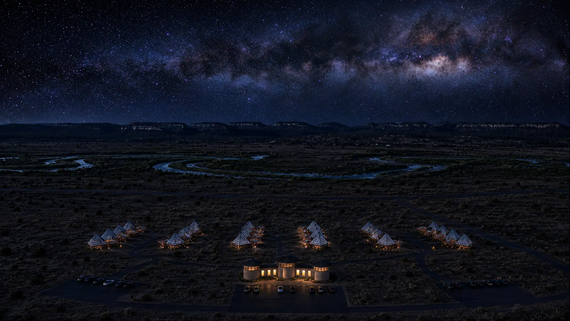
At Dark Light Collection, we are building glass pyramids on private land about 15 minutes from Bryce Canyon National Park, and Zion is about an hour from that site. The Bryce Canyon pyramids open in 2027, each with a king bed positioned for sky-gazing and a personal deck telescope for the nights after your Zion hikes. Once you cross over, the best hikes in Bryce Canyon pick up where Zion's river trails leave off.
Pick two or three things to do in Zion National Park from the table at the top, enter the Angels Landing lottery if the ridge is on your plan, and then map the drive east to Bryce Canyon.
Zion's darkest skies are on its east side and along Kolob Terrace Road. For the next clear night of the trip, the guide to stargazing at Bryce Canyon covers where to look.
Frequently asked questions
What is there to do in Zion without hiking?
You can roll along the paved Pa'rus Trail, which is open to wheelchairs, bikes and leashed pets, ride the free shuttle along Zion Canyon Scenic Drive in season, join a ranger-led program, or stay out after dark to stargaze. The Riverside Walk is also paved and mostly flat for its first half-mile.
Do you need a permit for Angels Landing?
Yes. Anyone continuing past Scout Lookout onto the Angels Landing Trail needs a permit from the Recreation.gov lottery. The climb from the Grotto to Scout Lookout needs no Angels Landing permit, so you can turn around there without one.
How many days do you need in Zion?
Plan two days to cover the paved walks plus one strenuous hike such as the Narrows or Angels Landing. Add a third day for Kolob Canyons, which sits 40 miles from Zion Canyon, or for a late night of stargazing.
Is Zion good for stargazing?
Yes. Zion is an International Dark Sky Park, so the park is very dark after sunset, and the darkest skies are on the east side and along Kolob Terrace Road. Plan around the Moon, since the darkest nights come in the week before a New Moon.
Follow Zion with a Night near Bryce Canyon
Founding deposits are open for the glass pyramids near Bryce Canyon, about an hour from Zion, opening in 2027.
Reserve Your Pyramid Stay near Bryce Canyon →