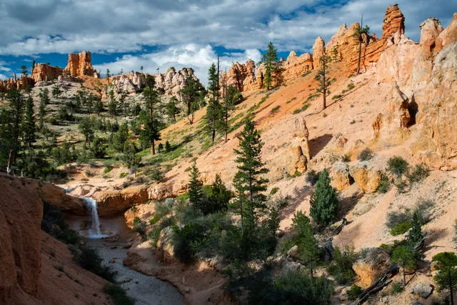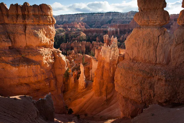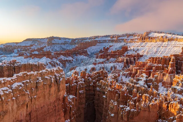

The National Park Service calls that 2.9-mile loop its most popular hike and the one it most recommends to first-time visitors. Shorter walks include the paved 0.5-mile stretch between Sunset and Sunrise Points.
The Best Bryce Canyon Hikes at a Glance
Ranked from least to most effort, using park distances and times:
| Trail | Distance | Time | Difficulty | Trailhead |
|---|---|---|---|---|
| Rim Trail | 1.0 to 11.0 mi | 1 to 7+ hours (varies by distance) | Easy to Moderate | Bryce, Inspiration, Sunset, Sunrise or Fairyland Point |
| Mossy Cave Trail | 0.8 mi round trip | 30 to 60 minutes | Easy | Highway 12, north end of the park |
| Bristlecone Loop | 1.0 mi | 30 to 60 minutes | Easy | Rainbow Point or Yovimpa Point |
| Queen's Garden Trail | 1.8 mi round trip | 1 to 2 hours | Moderate | Sunrise Point |
| Navajo Loop | 1.3 mi | 1 to 2 hours | Moderate | Sunset Point |
| Queen's/Navajo Combination Loop | 2.9 mi | 2 to 3 hours | Moderate | Sunrise or Sunset Point |
| Peekaboo Loop | 5.5 mi | 3 to 4 hours | Strenuous | Bryce Point |
| Fairyland Loop | about 8 mi | 4 to 5 hours | Strenuous | Fairyland Point or Tower Bridge trailhead |
If you only have time for one hike, pick the Queen's/Navajo Combination Loop. It joins the open hoodoo views of Queen's Garden with the switchbacks and tall canyon walls of the Navajo Loop, then brings you back along the rim with the amphitheater below you.
With an hour or less, walk the Rim Trail near Sunset Point, or drive to Mossy Cave or the Bristlecone Loop. Peekaboo and Fairyland are the two strenuous loops.
Easy Bryce Canyon Hikes
The easiest hike in Bryce Canyon is the paved Rim Trail section between Sunset and Sunrise Points, a 0.5-mile stretch with 34 feet of elevation gain. Start from either point and walk back for a 1-mile outing on concrete.
The Rim Trail
The full Rim Trail runs 5.5 miles from Bryce Point north to Fairyland Point along the edge of the Bryce Amphitheater. You can join it at any of five viewpoints and walk as much or as little as you like, which is why its time and difficulty span such a wide range. The sections break down like this:
- Bryce Point to Inspiration Point: 1.5 miles
- Inspiration Point to Sunset Point: 0.7 miles
- Sunset Point to Sunrise Point: 0.5 miles
- Sunrise Point to Fairyland Point: 2.8 miles
Only portions of the Rim Trail are considered accessible, including the paved section between Sunset and Sunrise Points. Pets are allowed on the Rim Trail only on the paved stretch between Sunrise and Sunset Points. Restrooms are open year-round at Sunset Point, and the General Store near Sunrise Point has seasonal restrooms and water.
Mossy Cave Trail
The Mossy Cave Trail sits at the northern end of the park, 4 miles east on Highway 12, and is one of the lowest-elevation hikes in Bryce Canyon. The round trip gains 150 feet and is one of the only hikes that climbs first and descends on the way back. One branch leads to Water Canyon and the other to Mossy Cave, a sheltered overhang that fills with moss in summer and icicles in winter.
You reach the trailhead without passing the park's fee booths, but Mossy Cave is still a fee area, so leave your park pass or proof of admission in the vehicle. During busy periods the area gets crowded between 10 AM and 6 PM. Parking along Highway 12 is not permitted and cars there may be ticketed, so come in the morning or evening, or return later if the lot is full.
Bristlecone Loop
The Bristlecone Loop starts at Rainbow Point or Yovimpa Point at the southern end of the park and reaches elevations over 9,100 feet. The trail gains 200 feet through a forest of blue spruce, Douglas fir and white fir, past bristlecone pines up to 1,800 years old. Vistas reach into the Four Corners area, and you are likely to see ravens and Steller's jays.
No park shuttle reaches Rainbow Point, though private options may be available. Oversized vehicles can park at the trailhead, and restrooms there are open seasonally.
Moderate Hikes into the Amphitheater
Queen's Garden, the Navajo Loop and the combination of the two are the moderate hikes that take you down among the hoodoos, each with less than 1,000 feet of elevation gain. Pets are not allowed on any of the three.
Queen's Garden Trail
Queen's Garden is the least difficult trail that descends from the rim into the Bryce Canyon Amphitheater. The out-and-back route starts near Sunrise Point and ends at a short spur to the Queen Victoria hoodoo, with 450 feet of elevation gain. Grades typically run 11 percent and reach 25 percent at the steepest point.
Navajo Loop
The Navajo Loop begins and ends at Sunset Point, with switchbacks that wind between narrow limestone walls past tall Douglas-fir trees and Thor's Hammer, the park's most famous hoodoo. It gains 515 feet, and its maximum grade of 30 percent makes it steeper than Queen's Garden. The loop has two sides, Wall Street and Two Bridges, and in summer it is best hiked counter-clockwise; the Navajo Loop Trail guide walks through each side.
Queen's/Navajo Combination Loop
The Queen's/Navajo Combination Loop links both trails into one hike of 2 to 3 hours with 625 feet of elevation gain. Descend Queen's Garden from Sunrise Point, climb either side of the Navajo Loop to Sunset Point, then walk the Rim Trail back to Sunrise Point. The park recommends hiking this loop in a clockwise direction.
You can start at either end, since both Sunrise and Sunset Points have parking and shuttle stops. Restrooms at Sunset Point are open year-round, and those at the General Store near Sunrise Point are seasonal.
Strenuous Loops Below Bryce Point and Fairyland Point
Peekaboo Loop and Fairyland Loop are the two strenuous hikes on this list, rated that way for rapid elevation gain and longer distances. Peekaboo's 1,560 feet of total ascent is about two and a half times the 625 feet on the combination loop.
Peekaboo Loop
Peekaboo Loop drops 670 feet from Bryce Point into a hoodoo-filled loop, then climbs back up to the rim. The round trip is 5.5 miles and takes 3 to 4 hours. In summer you will share the trail with horses and mules, and riders have the right-of-way.
Hike Peekaboo clockwise. The pit toilets on the west side of the loop are open in summer only, so carry what you need from the rim.
Fairyland Loop
Fairyland Loop is a quiet hike of about 8 miles that pairs rim walking near Boat Mesa with a canyon section and long views of the Bryce Amphitheater. Plan on 4 to 5 hours and 1,900 feet of elevation gain, hiked counter-clockwise. The trail narrows to 16 inches at its tightest point.
Start at Fairyland Point or at the Tower Bridge trailhead on the Rim Trail north of Sunrise Point. Fairyland Point has no services and no shuttle pick-up, so you must hike the whole loop back to wherever you parked. Starting near Sunrise Point puts you close to the General Store's seasonal restrooms and water.
Skip both loops if you have less than 3 hours. The combination loop gets you below the rim on two different trails in less time.
Bryce Canyon Hikes in Winter and on Snowshoes
Winter limits access to several trails, so plan around these limits:
- Navajo Loop: Wall Street side closed in winter; Two Bridges side open year-round. Hike Two Bridges as an out-and-back, or use it to finish the Queen's/Navajo loop.
- Rim Trail: the section from Bryce Point to Inspiration Point is regularly closed.
- Peekaboo, Fairyland and Bristlecone: each may be inaccessible in mid-winter, when snow depths range from 2 to 15 feet.
It is still a strenuous activity, and most snowshoers stick to the Rim Trail, the Bristlecone Loop, Fairyland Road and Paria Road. Use the month-by-month Bryce Canyon weather guide when you pick winter dates.
Ranger-led snowshoe hikes run when the park has at least 12 to 14 inches of snow and snow depth and staffing permit. They are free, include snowshoes and poles, usually last two hours and cover about a mile. Hikers must be at least 8 years old and wear waterproof boots, because tennis shoes are not permitted.
Sign up at the Visitor Center on the day of the program, starting at 8 a.m., until the group is full. There are no advance reservations. For your own gear, Ruby's Inn in Bryce Canyon City rents snowshoes and cross-country skis outside the park.
Full moon snowshoe hikes are among the rarest ranger programs, because both the full moon date and the weather must cooperate. Bring winter clothing and water to any snowshoe outing.
The Hike the Hoodoos Program
Hike the Hoodoos is a park program that turns hiking into a scavenger hunt: walk at least 3 miles on specially marked trails and find the benchmarks along the way. Take a rubbing of each benchmark or a photo of yourself with it, then show them to a ranger at the Visitor Center for a special reward. Nine benchmarks sit on eight trails, and collecting all nine means hiking every trail in the table.
| Trail | Distance | Benchmarks |
|---|---|---|
| Mossy Cave | 0.8 mi | 1 |
| Bristlecone Loop | 1.0 mi | 1 |
| Queen's Garden | 1.8 mi | 1 |
| Navajo Loop | 1.3 mi | 1 |
| Tower Bridge | 3.0 mi | 1 |
| Swamp Canyon Loop | 4.0 mi | 1 |
| Peekaboo Loop | 5.5 mi | 2 |
| Fairyland Loop | 8.0 mi | 2 |
Hikers often combine Queen's Garden and the Navajo Loop to pick up two benchmarks in one outing and claim the reward. Trail surfaces are unpaved, with steep grades and loose rock, and none of these trails is accessible for wheelchairs.
Shuttle, Water and Climb-Out Tips
Ride the shuttle to the rim trailheads and save your energy for the climb back to the rim.
Shuttle and Parking
In 2026 the park shuttle runs April through mid-October, and riding it is optional but recommended. It stops at Bryce, Inspiration, Sunset and Sunrise Points, so you can start a Rim Trail walk at one viewpoint and ride back from another. Fairyland Point, Mossy Cave and Rainbow Point have no shuttle service, though private options may be available.
While the shuttle runs, oversized vehicles cannot park at Bryce, Inspiration, Sunset or Sunrise Point. Fairyland Point, Mossy Cave and the Bristlecone Loop trailheads accept them.
Water and Restrooms
The water-fill station at the Sunset Point restroom is available year-round. The other station at Sunset Point and the one at the General Store are seasonal. Fill up before you head down, because Fairyland Point has no services and Peekaboo has only summer pit toilets.
The Climb Out
Peekaboo drops from Bryce Point before ascending back to it, and Queen's Garden and the Navajo Loop both start on the rim. Turn around early if the descent already feels hard, since every foot you go down is a foot you climb back up.
Staying Near the Trailheads
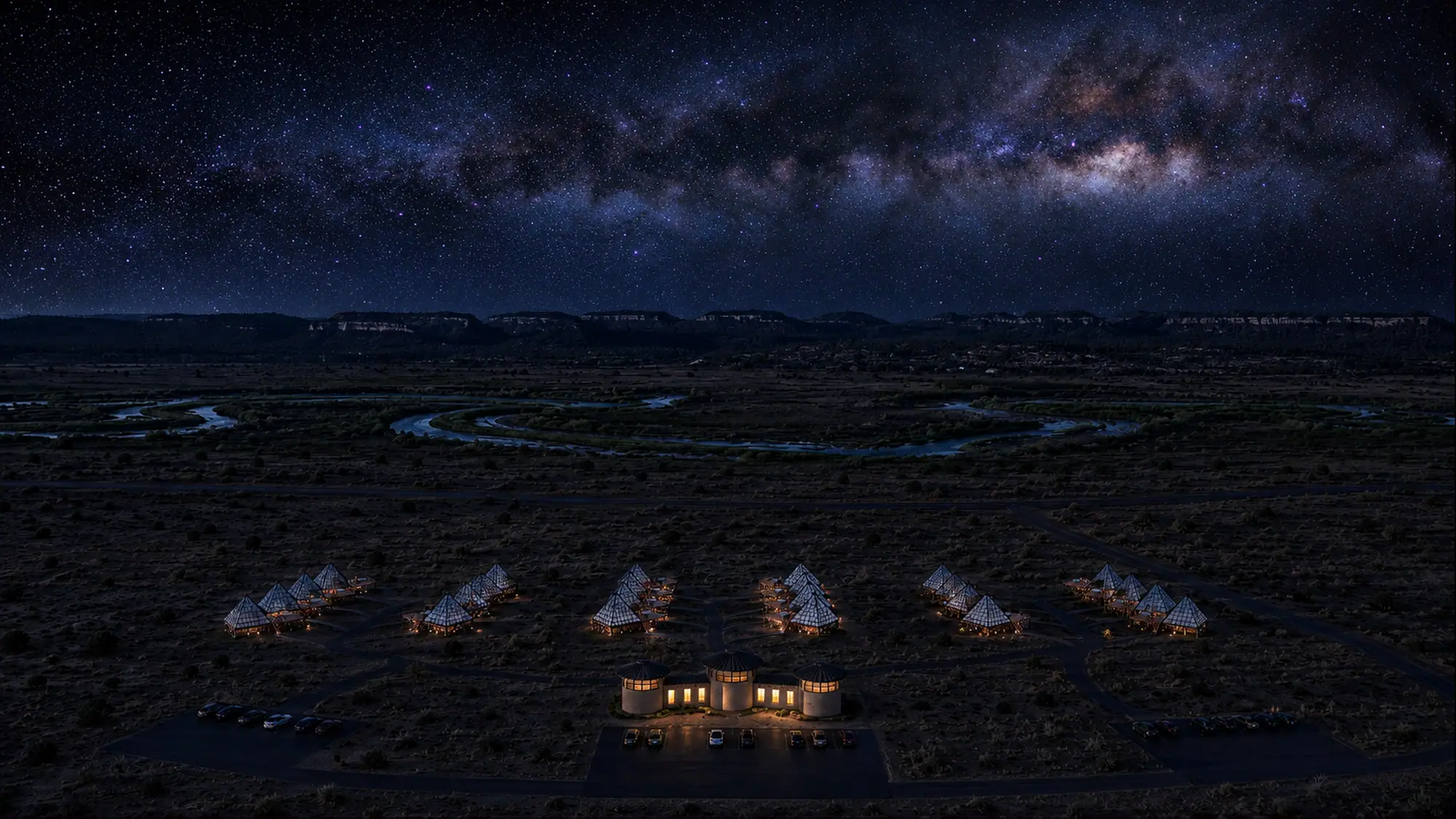
At Dark Light Collection, we are building glass pyramids on private land about 15 minutes from Bryce Canyon National Park, with Red Canyon about 10 minutes away, opening in 2027. See the Bryce Canyon pyramids if you want an early start at the rim without a long drive.
Pick one moderate hike and one easy one from the table, then read current trail conditions on the Bryce Canyon National Park website before you set out on your Bryce Canyon hikes.
If you plan to stay out after dark, read the Bryce Canyon stargazing guide before you leave the trailhead, and pack a warm layer for the walk back to the car.
Frequently asked questions
What is the most popular hike in Bryce Canyon?
The Queen's/Navajo Combination Loop is the most popular hike in Bryce Canyon and the park's top recommendation for first-time visitors. It runs 2.9 miles from Sunrise Point down Queen's Garden, up the Navajo Loop to Sunset Point and back along the Rim Trail.
What is the easiest hike in Bryce Canyon?
The easiest hike is the paved Rim Trail section between Sunset and Sunrise Points. Walk it out and back for about a mile on concrete that is accessible and open to pets.
How many days do you need to hike Bryce Canyon?
One day covers the combination loop, Mossy Cave and the Bristlecone Loop in roughly 4 to 5 hours of walking (2 to 3 hours plus about an hour each), before driving between trailheads. Add a second day for Peekaboo and Fairyland, which take 7 to 9 hours together.
Sleep Under Glass Near Bryce Canyon
Founding deposits are open for glass pyramids about 15 minutes from Bryce Canyon National Park, opening in 2027.
Reserve Your Pyramid Stay near Bryce Canyon →