
The Bryce Canyon scenic drive covers 18 miles from the amphitheater area south to Rainbow Point and Yovimpa Point. At Dark Light Collection, we are building glass pyramids about 15 minutes from Bryce Canyon National Park, and we ordered these stops from the park's own mile markers. The road passes nine viewpoints along the rim of the Paunsaugunt Plateau. Drive to the southern end first, then stop at each overlook on the way back north.
The Bryce Canyon Scenic Drive Stop by Stop
The southern scenic drive begins south of the Bryce Amphitheater and ends at Rainbow Point. This order is our pacing suggestion, not a park rule.
Reserve Your Stargazing Pyramid Near Bryce Canyon
Get early access to our pyramids near Bryce Canyon and Glacier, with priority booking to all locations.
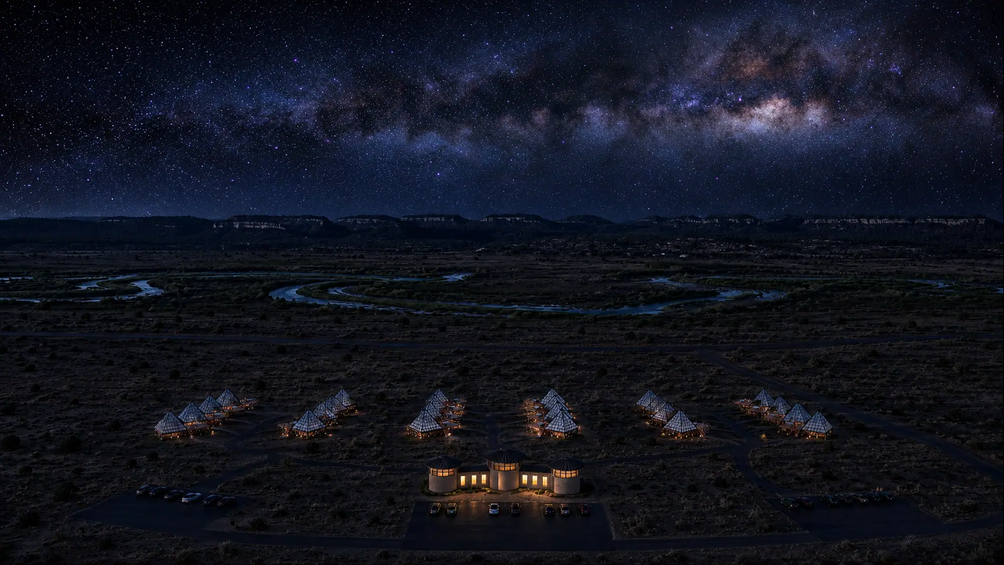
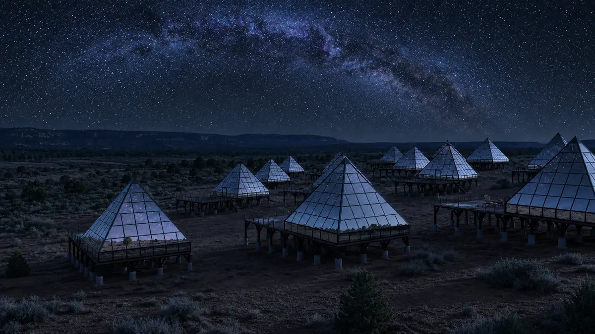
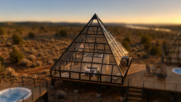
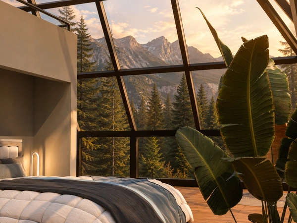
Concept renderings
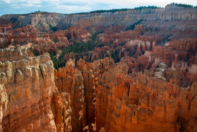
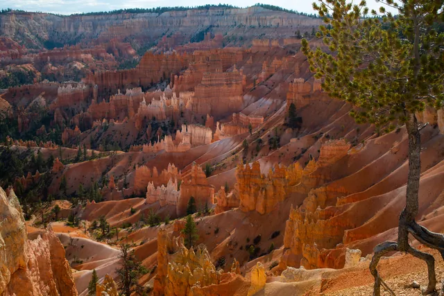
Nine viewpoints line the road south of the amphitheater, plus the Whiteman Bench picnic area. While popular stops like Sunset Point sit within the northern amphitheater loop, the southern road climbs into mixed conifer forest above the Rainbow Point amphitheater.
| Viewpoint or Stop | Mile Marker | Features and View |
|---|---|---|
| Swamp Canyon | Mile 6.0 | Wetland vegetation, tiger salamander habitat, and Mud and Noon Canyon Buttes |
| Whiteman Bench Picnic Area | Mile 9.5 | Picnic tables, Under-the-Rim Trail access, and forest recovering from the 2009 Bridge Fire |
| Farview Point | Mile 10.25 | Restrooms, 90-mile distant vistas toward Navajo Mountain, and trail access to Piracy Point |
| Natural Bridge | Mile 12.25 | An 85-foot natural arch carved through the iron-rich mudstone of the Pink Cliffs |
| Agua Canyon | Mile 13.5 | Two prominent hoodoos named The Hunter and The Rabbit alongside Paria Valley vistas |
| Ponderosa Canyon | Mile 14.75 | Canyon floor forest with ponderosa pines exceeding 5 feet in diameter and 150 feet in height |
| Black Birch Canyon | Mile 16.5 | Quaking aspen groves, 1,000-foot drops to the forest floor, and views across the Paunsaugunt Plateau |
| Rainbow Point & Yovimpa Point | Mile 18.0 | Highest overlooks at 9,115 feet, Bristlecone Loop trailhead, historic CCC shelter, and 100-mile views |
We ordered the stops by the park's published mile markers. Plan to drive to the south end first and visit viewpoints on the return.
Rainbow Point and Yovimpa Point Overlooks
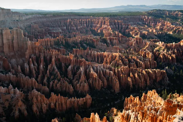
At 9,115 feet above sea level, Rainbow Point and neighboring Yovimpa Point represent the highest viewpoints in the park. Tilting during uplift left this southern end of the park about 1,000 feet higher than the northern end near the visitor center. Looking north from Rainbow Point reveals the full sweeping curve of the Paunsaugunt Plateau, where millions of years of water and ice have carved bowl-shaped amphitheaters into iron-oxide limey mudstones.
Yovimpa Point looks south over the full sweep of the Grand Staircase. On clear days the view runs over 100 miles across the Grand Staircase. Geologist Clarence Dutton named its five steps in the 1870s: the Pink, Grey, White, Vermilion and Chocolate Cliffs. Beyond these steps, the dome of Navajo Mountain rises over 80 miles away near Page, Arizona. Navajo Mountain is a laccolith, formed when a rising plume of molten rock blistered the crust without erupting as an active volcano. On the horizon to the south, the Kaibab Upwarp marks the north rim of the Grand Canyon.
From the shared parking lot, the Bristlecone Loop Trail offers one of the best hikes in Bryce Canyon for high-elevation ecology. This easy 1.0-mile loop gains 200 feet of elevation through a mixed conifer forest of white fir, Douglas fir, and blue spruce. Along the rim, you will pass Great Basin bristlecone pines that are up to 1,600 to 1,800 years old. These ancient trees thrive on exposed dolomitic limestone, where high concentrations of calcium and magnesium prevent other vegetation from competing. Bristlecone pines retain their green needles for up to 40 years, clustered in dense bundles of five resembling a bottle brush.
The parking area also hosts the historic Rainbow Point Shelter, constructed in the summer of 1940 by the Civilian Conservation Corps (CCC). Built as a museum-overlook, the structure was added to the National Register of Historic Places on April 25, 1995. Because summer thunderstorms produce frequent lightning strikes along exposed rim structures, visitors must leave the shelter and return to their car whenever thunder sounds.
Natural Bridge and Agua Canyon Formations
Natural Bridge sits at Mile 12.25 along the plateau rim. Despite its name, Natural Bridge is technically a natural arch spanning 85 feet. True natural bridges are carved by the running waters of streams or rivers. Here, the arch formed through frost-wedging, chemical weathering, and gravity without a stream present. Rain and melting snow seep into vertical joints within the Claron formation mudstone. When nightly temperatures drop below freezing, expanding ice splits the rock from inside, gradually carving a window that leaves a gully flowing with rain and snow more than 125 feet below.
Further south at Mile 13.5, Agua Canyon features two prominent rock spires set against the Paria Valley. On the left stands a tall tower known as The Hunter, which supports hardy limber pines cached as seeds by Clark's nutcrackers. To the right rises a separate formation historically documented as The Rabbit or The Backpacker. In the park's early years, observers named dozens of hoodoos after familiar objects, but natural erosion regularly alters their silhouettes. The Agua Connecting Trail below the overlook remains indefinitely closed due to rockslides and extremely unstable conditions.
Looking east from Agua Canyon across the Paria Valley, the Table Cliff plateau rises to 10,000 feet. It exposes the same Pink Cliffs found at Bryce Canyon, separated by nearly 2,000 feet of vertical displacement along the Paunsaugunt fault. In the distance, the Henry Mountains appear on clear days 86 miles away. Like Navajo Mountain, the Henry Mountains are volcanic laccoliths whose hard igneous cores were exposed as surrounding sedimentary beds eroded away over millions of years.
Farview Point to Black Birch Canyon
The middle section of the scenic drive traverses distinct ecological zones and expansive valleys between Mile 6 and Mile 16.5. Farview Point at Mile 10.25 sits at a transitional boundary where northern ponderosa pine forests give way to mixed conifer stands. A short, flat, unpaved trail measuring 0.15 miles extends north from Farview parking to Piracy Point. Piracy Point overlooks Swamp Canyon and marks a geologic drainage divide where the Willis Creek system will eventually capture the waters of Sheep Creek through stream piracy.
Visitors can also watch for wildlife at Farview Point and Piracy Point. A pair of osprey nests nearby, flying two air miles west to Tropic Reservoir to catch fish before returning to the rim. In July 1999, two condors wearing tags 82 and 93 were spotted perched at overlooks along the park's southern end. Below the rim, the grey shale badlands transform into the iron-rich sandstones of the White Cliffs, where Kodachrome State Park is located in this transition zone.
Continuing south past the Whiteman Bench picnic area at Mile 9.5, you will encounter Ponderosa Canyon at Mile 14.75 and Black Birch Canyon at Mile 16.5. Ponderosa Canyon earns its name from immense ponderosa pines growing on the sheltered canyon floor, with individual trunks exceeding 5 feet in diameter and heights topping 150 feet. From the viewpoint rim, however, you stand among high-altitude Engelmann spruce and Douglas fir. Black Birch Canyon preserves a historical misidentification: quaking aspen were likely mistaken for eastern black birch.
Driving the Southern Road Without a Shuttle
Exploring the southern scenic drive requires private vehicle transportation, as the free park shuttle does not operate along this corridor. While the National Park Service runs the park shuttle throughout the Bryce Amphitheater area from April through mid-October, service terminates at Bryce Point. The shuttle ran from April 3 to October 18 in 2026, operating every 15 minutes to reduce northern parking congestion. Furthermore, the three-hour Rainbow Bus Tour is not being offered, meaning visitors cannot take a park tour to the southern overlooks.
Drivers of oversized vehicles must observe specific parking restrictions. Vehicles measuring 23 feet or longer are prohibited from parking during shuttle hours at Sunrise Point, Sunset Point, Inspiration Point, Bryce Point, Bryce Lodge, and the visitor center one-hour lot. Paria View prohibits oversized vehicles at all hours due to parking lot size. Oversized vehicles are permitted at the Rainbow Point trailhead parking lot.
The main park road remains open throughout the winter, with snowplow crews clearing the route after passing winter storms. Winter visitors should review Bryce Canyon weather by month to anticipate sudden drops in temperature and heavy snowfall. During mid-winter, snow depths along the southern plateau rim can range from 2 to 15 feet. While main road pavement is maintained, side trails such as the Bristlecone Loop may become inaccessible during mid-winter due to deep snow. The side road to Paria View closes to vehicles throughout the winter months to provide for winter activities like cross-country skiing and snowshoeing.
For a mid-drive rest, Whiteman Bench at Mile 9.5 provides picnic tables set amidst forest regenerating from the 2009 Bridge Fire. That blaze burned around 3,500 acres across park and Forest Service land, leaving standing dead snags that now offer habitat for woodpeckers, nuthatches, and owls.
Planning the Bryce Canyon Scenic Drive for Sunset and Night Skies
Yovimpa Point provides a vantage extending over 100 miles across the Grand Staircase toward the Kaibab Upwarp.
This self-guided drive is not suitable for travelers who rely exclusively on the park shuttle, because public transit buses do not travel south of the amphitheater. If park officials reinstate the Rainbow Bus Tour or introduce southern shuttle lines in future operating seasons, travelers without private transportation would gain direct access to these viewpoints. Severe winter storms can also alter your plans, as temporary road closures occur along the high plateau until snowplows clear the roadway.
Bryce Canyon was certified as an International Dark Sky Park in 2019. Viewing stars from high-elevation pullouts like Farview Point or Rainbow Point showcases the park's dark skies. Our glass pyramids open in 2027 about 15 minutes from the park. Our pyramids are arranged in an Orion's Belt pattern, and each has triple-pane glass heated for snow-melt, smart privacy glass, a king bed positioned for sky-gazing and a personal deck telescope. Drive the full road to Rainbow Point first, work back through Natural Bridge and Agua Canyon, then end the day at our Bryce Canyon pyramids.
Rainbow Point tops 9,000 feet under certified dark skies, and our Bryce pyramids about 15 minutes from the park keep the night sky close after the drive.
Frequently asked questions
How long does the Bryce Canyon scenic drive take?
Driving time for the 18-mile route to Rainbow Point and back varies depending on stops at the scenic overlooks. Allow extra time if you plan to hike the 1.0-mile Bristlecone Loop Trail at the southern end.
Does the Bryce Canyon shuttle go to Rainbow Point?
No, the park shuttle operates only within the Bryce Amphitheater area and does not travel down the southern scenic drive. The three-hour Rainbow Bus Tour is also not being offered, so you must use a private vehicle.
Is the Bryce Canyon scenic drive open in winter?
The main park road is plowed and remains open during the winter, though temporary closures occur during and immediately after heavy snowstorms. Paria View spur road closes to motor vehicles all winter for cross-country skiing and snowshoeing.
What is the highest point on the Bryce Canyon scenic drive?
Rainbow Point and Yovimpa Point mark the highest viewpoints along the drive at an elevation of 9,115 feet. This is approximately 1,000 feet higher than the visitor center area in the northern portion of the park.
Is Natural Bridge on the scenic drive?
Yes, Natural Bridge is located at Mile 12.25 on the southern scenic drive. The viewpoint overlooks an 85-foot natural arch carved through the iron-rich mudstone of the Pink Cliffs.
Reserve Your Stargazing Pyramid Near Bryce Canyon
Get early access to our pyramids near Bryce Canyon and Glacier, with priority booking to all locations.
Reserve Your Pyramid Stay near Bryce Canyon →