
Bryce Canyon hoodoos formed through sediment deposition, tectonic uplift, and severe freeze-thaw weathering. At Dark Light Collection, we are building glass pyramids about 15 minutes from Bryce Canyon National Park, and we put this explanation together from the park's own geology pages. Ancient streams carried clays, silts, and sands into a lake system about 50 million years ago, creating the Claron Formation. Regional plate collisions elevated the plateau to high altitudes where ice wedging and slightly acidic rainfall carved the exposed rock into tall rock spires.
How Bryce Canyon Hoodoos Form
Ice wedging on more than 170 freeze-thaw nights a year does most of the carving, after two earlier steps built and lifted the rock. Deposition began about 50 million years ago when an ancient freshwater lake and floodplain system covered southwestern Utah. Streams eroded clays, silts, and sands from western highlands, depositing minerals into the low basin to create the limestones, dolostones, and mudstones of the Claron Formation.
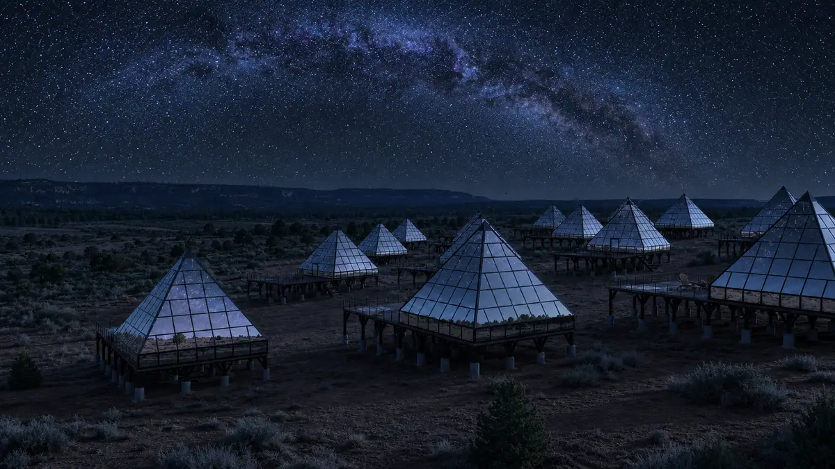
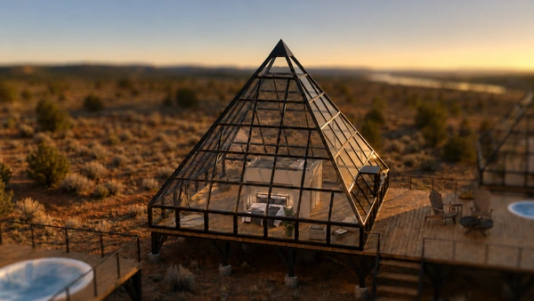
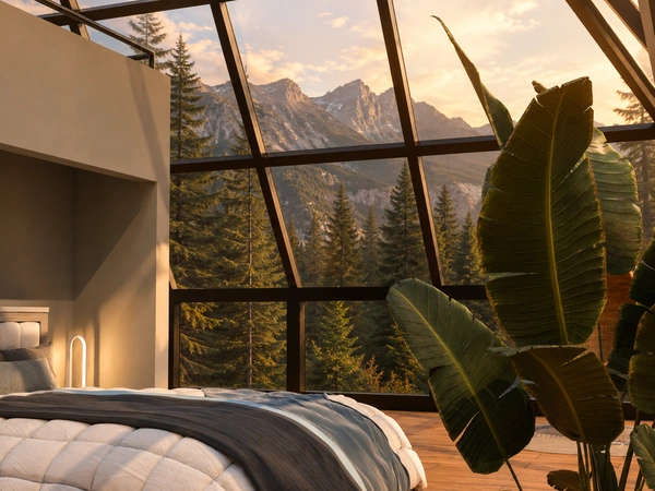
Stay Under the Dark Sky at Bryce Canyon
Get early access to our pyramids near Bryce Canyon and Glacier, with priority booking to all locations.
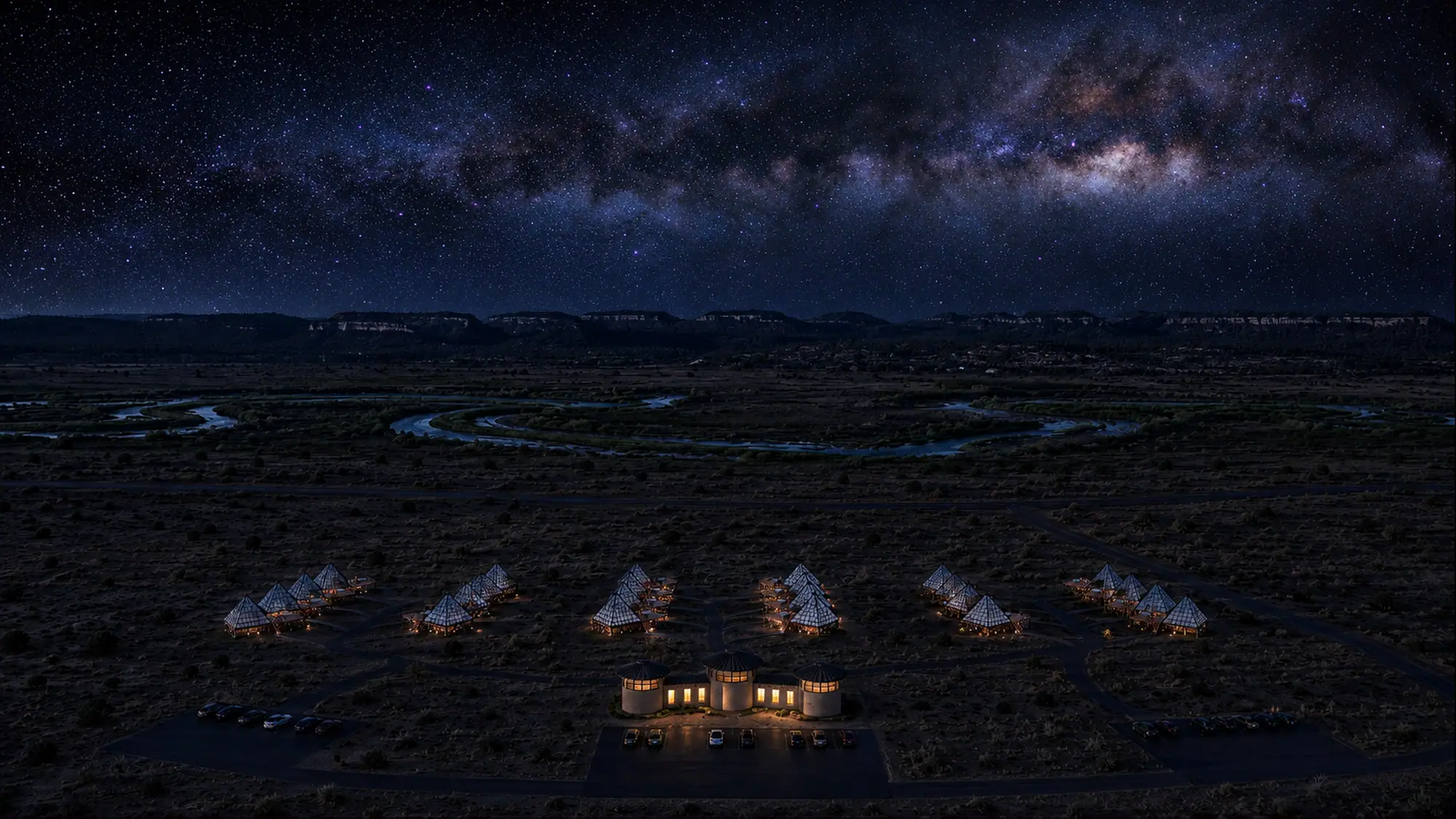
Concept renderings
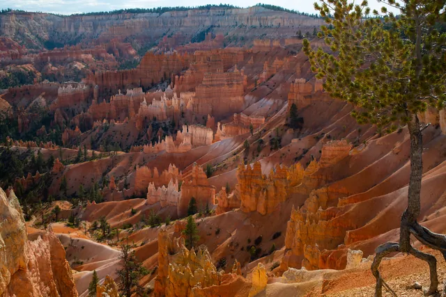
The Claron Formation splits into two members with distinct colors and mineral compositions. The lower Pink Member contains sand, silt, and oxidized iron that give the stone its red and orange shades. Above it sits the upper White Member, composed of purer freshwater limestone that forms paler layers near the rim.
These rock layers originated near sea level before tectonic forces drove them upward. A head-on collision between the North American Plate and the Farallon Plate forced the Farallon Plate underneath the North American Plate. Heat generated as the Farallon Plate began breaking apart caused the Colorado Plateau to rise, lifting the rock layers to elevations between 8,000 feet and a maximum elevation of 9,115 feet.
At an elevation of 8,000 feet, the plateau sits in an active freeze-thaw zone. Temperatures cross the freezing point on over 170 nights out of the year. Melted snow and rain seep into vertical joints in the rock during the day, settling deep inside the fractures.
When night falls and temperatures plunge below freezing, the trapped water expands 9 percent as it turns into ice. This expansion exerts tremendous pressure against the surrounding rock walls, wedging open fractures in a process called ice wedging. Over time, recurring frost wedging breaks solid rock apart into distinct walls, windows, and spires.
Chemical weathering from rain completes the sculpting sequence. Slightly acidic precipitation dissolves the calcium carbonate binding the limestone layers together. Strata with denser calcium carbonate cementation resist dissolution, leaving protective caprocks that shield the softer rock beneath from collapsing.
Check Bryce Canyon weather to see how seasonal temperature shifts drive this freeze-thaw cycle. Ice and rain are still reshaping the amphitheater walls today.
Hoodoo Definition and Rock Structure
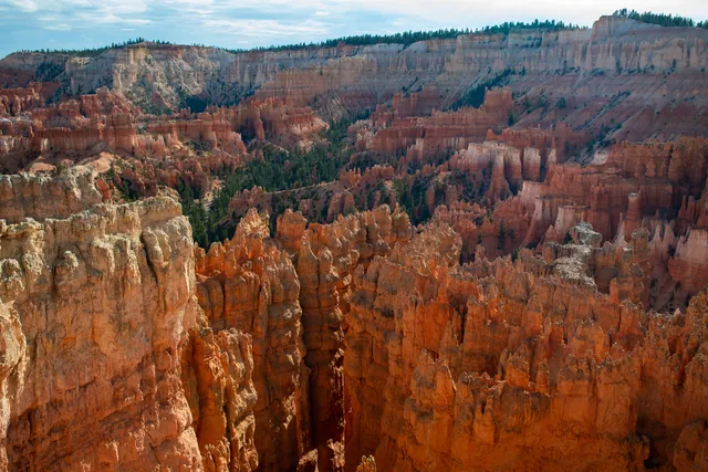
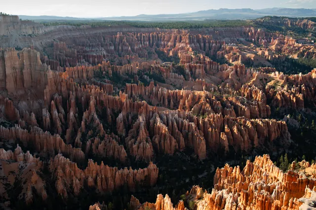
A hoodoo is an irregular, weather-sculpted spire of sedimentary rock. The Bryce Amphitheater holds the largest collection of hoodoos on Earth. Hoodoos display indented and protruding layers caused by varying resistance across rock strata.
The progression from a flat plateau to an isolated hoodoo requires several stages of erosion. First, runoff cuts parallel gullies along the plateau rim, creating narrow rock walls known as fins. As frost wedging splits vertical fissures through the fins, holes open in the rock walls to form windows.
Windows gradually widen as ice fractures their inner edges. When the upper bridge collapses under gravity, the remaining rock columns stand as freestanding hoodoos. Durable caprock layers atop each pillar protect the softer underlying limestone from immediate rain erosion.
Plateau edges in the park erode backward at an estimated rate of 1 to 4 feet every century. This ongoing erosion means today's hoodoos will eventually crumble, while receding rim cliffs produce new fins behind them. The entire amphitheater remains in active transition.
Southern Paiute communities maintain sacred traditions regarding these rock spires. Their oral traditions described the pillars as the Legend People, turned into stone by Coyote. The Southern Paiute phrase for the amphitheater translates as "Red Rock Standing Like a Man in a Hole."
Where to See the Most Hoodoos
The Bryce Amphitheater contains the highest concentration of hoodoos in the park, providing wide views from four primary rim viewpoints. Each overlook offers a distinct vantage point across the dense limestone spires below.
Inspiration Point features a tiered rim viewing area with three ascending observation decks. The upper platform looks south toward Bryce Point and the Wall of Windows, and the view north takes in the Silent City, dense rows of rock walls just south of Sunset Point. Visitors can access Inspiration Point via park shuttles or along the rim path.
Bryce Point anchors the southern end of the amphitheater at a high rim perch. Geologic features visible from here include the Wall of Windows near Inspiration Point. Looking east across the Paria Valley, visitors can see distant plateaus extending toward the horizon.
Sunset Point sits directly above some of the park's most famous rock formations. From the rim here, you look down on Thor's Hammer and the spires around it. Our Sunset Point and Thor's Hammer guide covers the view. Sunrise Point lies nearby, overlooking the Queen's Garden and the flat top of Boat Mesa.
Fairyland Point, north of the main amphitheater, shows younger hoodoos.
| Overlook | Formations to Find | Vantage Perspective |
|---|---|---|
| Inspiration Point | Silent City and Wall of Windows | Tiered views over dense rock fins |
| Bryce Point | Southern amphitheater and Paria Valley | Wide southern rim lookoff |
| Sunset Point | Thor's Hammer and Silent City maze | Direct views into rock spires |
| Sunrise Point | Queen Victoria and Boat Mesa | Overlook toward Queen's Garden and Boat Mesa |
| Fairyland Point | Younger hoodoos | Viewpoint along northern rim |
Walking Among the Hoodoos
Walking designated trails below the rim allows hikers to stand directly among towering hoodoos and observe their textured rock layers. Looking up from the canyon floor reveals the immense scale of the fins and windows carved overhead.
The Navajo Loop Trail spans 1.3 miles as it descends below the rim. The Queen's Garden Trail covers 1.8 miles from Sunrise Point into the amphitheater. Hikers often merge Queen's Garden with the Navajo Loop to complete a 3-mile circuit through the amphitheater.
Visitors can also join the official Hike the Hoodoos program managed by the park. Participants hike at least 3 miles across designated park routes to find hidden benchmark survey markers. Hikers who present rubbings or photos of these benchmarks at the visitor center receive a commemorative prize.
For longer explorations, the 5.5-mile Peekaboo Loop winds through the heart of the lower amphitheater beneath Bryce Point. The trail passes below the Cathedral and descends through an engineered hole in the rock. Hikers seeking longer paths can take the 8-mile Fairyland Loop.
Hoodoos After Dark
Nightfall brings freezing temperatures and quiet darkness across the hoodoos, revealing pristine starry skies above the stone amphitheater.
In 2019, Bryce Canyon achieved certification as an International Dark Sky Park. We are building glass pyramids about 15 minutes from Bryce Canyon National Park, opening in 2027. Our accommodations feature private observation decks and personal telescopes designed for stargazing in comfort. Explore our Bryce Canyon pyramids to secure early access and view the constellations from your private bedroom.
For the widest view, go to Inspiration Point or Bryce Point. To stand among the spires, walk Queen's Garden or the Navajo Loop, which many hikers combine into a 3-mile loop. Visit between October and May to see the freeze-thaw season that wedges the rock apart.
Under Bryce Canyon's dark skies, freezing nights from October to May keep the ice wedging going.
Frequently asked questions
How many hoodoos are in Bryce Canyon?
Continuous weathering keeps reshaping the spires, so the hoodoos in Bryce Canyon have no fixed count. The Bryce Amphitheater holds the largest concentration of hoodoos on Earth.
Is Bryce Canyon the only place with hoodoos?
Bryce Canyon is not the only place with hoodoos, but it holds the highest concentration in the world.
How long do hoodoos last?
Individual hoodoo lifespans vary depending on caprock durability and rock composition. The plateau rim recedes at a rate of 1 to 4 feet every century, meaning spires continually form, erode, and collapse over thousands of years.
What are Bryce Canyon hoodoos made of?
Bryce Canyon hoodoos are made of sedimentary rock from the Claron Formation, including limestone, dolostone, mudstone, siltstone, and sandstone. The lower Pink Member contains oxidized iron minerals that produce vibrant red and orange tones, while the upper White Member consists of purer freshwater limestone.
Where is the best place to see hoodoos at Bryce Canyon?
Inspiration Point and Bryce Point offer the best wide vistas overlooking the hoodoos within the Bryce Amphitheater. The Navajo Loop and Queen's Garden Trail provide routes for standing directly beside the formations.
Stay Under the Dark Sky at Bryce Canyon
Get early access to our pyramids near Bryce Canyon and Glacier, with priority booking to all locations.
Reserve Your Pyramid Stay near Bryce Canyon →